The latest drought monitor released Thursday Sept. 14 continues to show an ugly expanse of Extreme and even Exceptional Drought across Iowa, Minnesota and Wisconsin. Looking longer range, however, some relief may be in sight.
The 200mb pattern centered on Sept. 23 based on the European Ensemble.
The overall pattern looks to get more energized by late September, especially in the Sept. 22-29 time frame. A rather rigorous subtropical jet is forecast to develop bringing stormy weather to the central/Midwest US. The agreement in the European Ensemble is quite promising to bring moisture and Upper-Level support for precipitation.
Analogs for precipitation centered Sept. 22-25.
Latest analogs show a classic early-autumn rain event with above-normal precipitation looking increasingly likely. Probabilities of above-normal precipitation are approaching 70% which is a strong signal this far out.
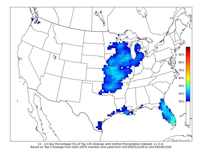
Probabilities of 1” based on analogs.
Even nearly two weeks out we are seeing heightened potential of 1"+ rainfall across much of the central US. This is a rather promising signal and bodes well for beneficial rains.
European ensemble precipitation matrix.
Above you can see the 50 members of the European Ensemble laid out through nearly the end of September. There is a noticeable trend towards the latter half of the period of more active weather. Mean precipitation is approaching 2” by the end of the month.
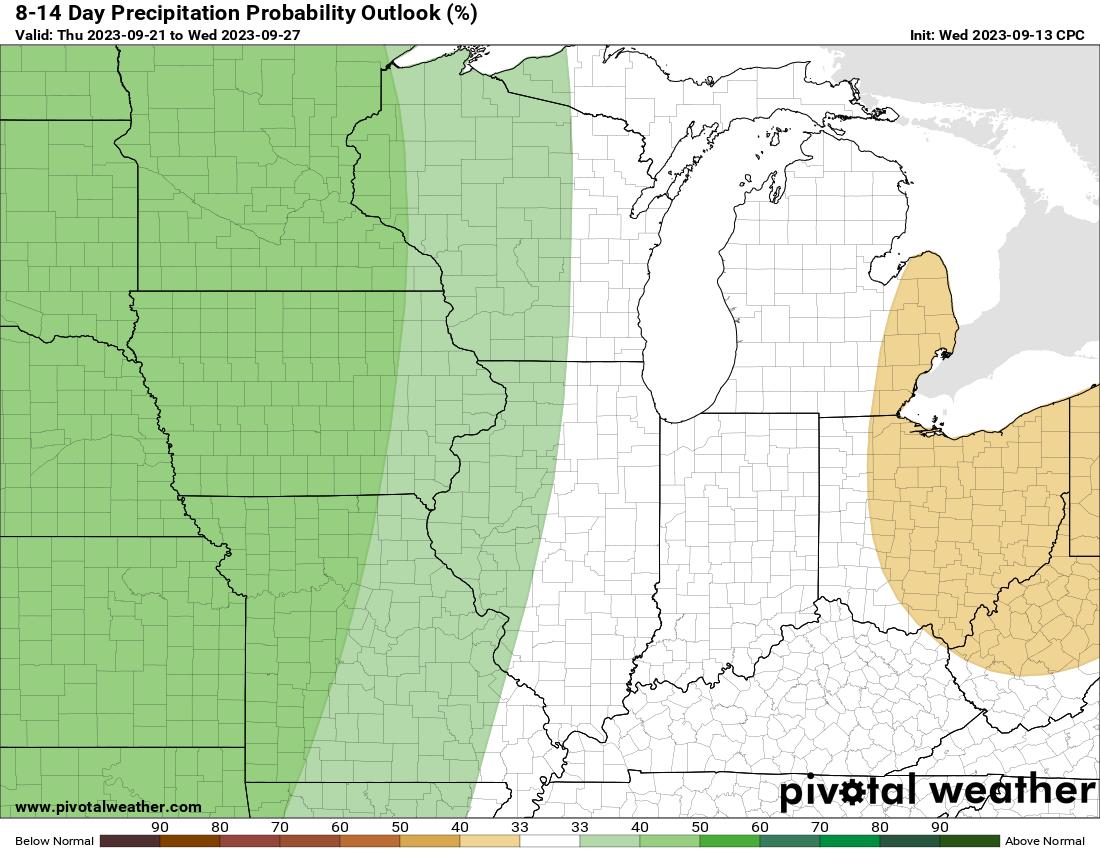
CPC forecast days 8-14.
The latest Climate Prediction Center forecast is also honing in on the increased potential of above-normal precipitation.
Bring it on.
-Meteorologist Nick Stewart


