As we enter Meteorological Winter the overall pattern across the United States is looking fairly mild based on numerous forecasting tools. While there could still be shots of cold here and there, the overall average is above-normal for this time of year. Let’s dig deep into some of the meteorology.
TELECONNECTIONS
The Arctic Oscillation has a tendency to move into positive category by Mid-December which is a warm signal for the United States.
A series of teleconnections we use to forecast the weather are hinting at a warming trend for the United States through mid/late December, and this could have implications into January as well.
After a brief dip into negative territory, one index we use, the AO or Arctic Oscillation, pushes into positive category using the European Ensemble. The control surges well into positive territory. In winter for the United States, a positive AO tends to favor warmer/above-normal temperatures.
The North Atlantic Oscillation has a tendency to move into positive category by Mid-December which is a warm signal for the United States.
Another teleconnection, the NAO or North Atlantic Oscillation, follows similar rules regarding positive values meaning warmer/above-normal temperatures for the US. Like the AO, the forecast moved into positive territory and will likely have a lasting impact into mid/late December, potentially continuing into January as well.
These two indices alone tell me a lot, but we can continue to dig deeper.
Another oscillation we use is the MJO or the Madden–Julian Oscillation. This tends to be a fantastic indicator for temperature tendencies in the next 1-2 weeks, especially in winter. What we are looking at is a tendency for the forecast to swing into Phases 5/6 which in December is a strong above-normal signal in the United States. This is a strong indicator and just builds on the NAO/AO we noted above.
THE ANALOGS
Analogs are indicating a warming trend in mid-December.
Another tool in the toolbox we use to forecast general trends in the coming 1-3 week time frame are analogs. These use model data and, based on historical weather events that are similar to the forecast, can show likelihoods of certain events unfolding.
Analogs are hinting at an above-normal trend in mid-December with a 60-70% likelihood. Just another way to visualize what appears to be a warming trend deeper into December.
A POTENTIAL WILDCARD
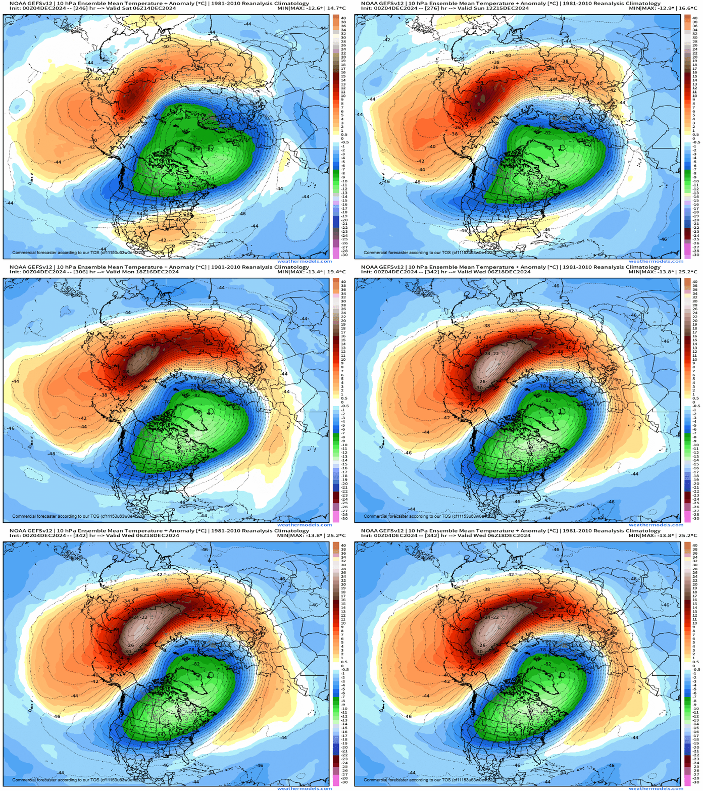
While December looks to be a pretty clear slam-dunk for above-normal temperatures, there is one potential indicator that January may look different. High up above our heads, models are indicated a potential sudden warming of the stratosphere. The timing and magnitude of this warmup has significant implications on what this could mean for North America.
If we do in-fact see a sudden stratospheric warming event, this would send this cold air about 6-10 days following its onset. This could be around December 28 (+/- 4 days).
In some cases, if things unfold the right way, this could dislodge the Polar Vortex and send a slug of bitter cold into the United States. This is highly, highly uncertain at this point in time but it’s at least something to watch as the overall pattern is unimpressive for the next 1-2 weeks.
OFFICIAL FORECAST
I’ll end with the official two-week forecast from the Climate Prediction Center which is latching onto what I am discussing regarding above-normal temperatures as we dance into mid-December.
More details as they come…
-Meteorologist Nick Stewart


