Confidence continues to increase a potent storm system will traverse the central US in the January 9-11 time frame bringing the combination of snow, heavy snow and strong wind gusts. While confidence in amounts remains low as we remain several days out, the confidence continues to be rather high a storm will bring travel impacts to the region.
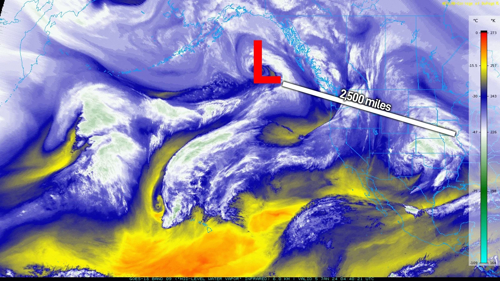
Water vapor satellite image late Thursday evening.
Let’s start with some context. The storm we are dealing with right now is more than 2,500 miles from the Tri-State region of Illinois, Iowa and Missouri. When it comes to high-impact snow, a difference of 60 miles means all the difference between rain, snow, a combination of the two or nothing at all. So when it comes to forecasting these things just know this is still a long ways away.
The European and American (GEFS) Ensembles remain in good agreement in terms of timing, placement and strength of the upper air pattern that will fuel the rapid development of the storm across the Southern Plains before it turns into the Midwest.
This alone indicates there will be a strong storm system, it just comes down to the details now.
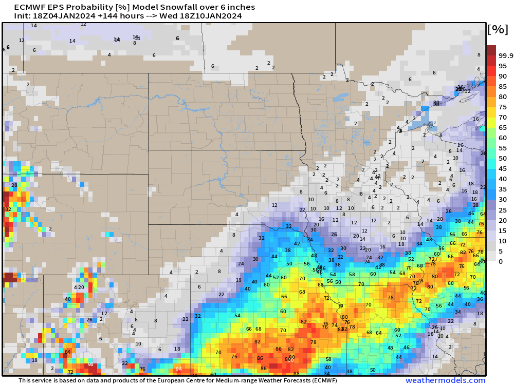
The models are slowly honing in on the area at most risk of heavy snowfall with this system. The latest probability forecast off the European Ensemble shows a strong 70-80% chance of 6” of snow from Kansas, into northern Missouri, southeast Iowa, northern Illinois and southern Wisconsin.
While this can still shift, the theme is starting to really come into the light. An axis of heavy snow is likely that could push 6-8”, or more, along and just northwest of the low track.
The spread in surface lows has tightened considerably over the last 36 hour. There is a tight grouping of potential low locations valid noon Tuesday right around the St. Louis, Missouri area. This is a classic setup for heavy snow in northern Missouri and Illinois.
The threat of heavy snow will coexist with strong wind gusts in the 30-40mph range. This could lead to significant blowing and drifting of falling and snow already on the ground. This could lead to significant travel impacts across a wide area Tuesday and Wednesday.
In addition, slower to the low where the snow may be heavier and wetter, the snow buildup on trees and powerlines with the strong winds could also lead to issues with power. As of now wind gusts aren’t absurd, but this is worth watching anytime you have a rapidly strengthening low and will be better visualized on high-resolution models closer to the storm’s onset.
THE BOTTOM LINE
While we' remain a few days away, now would be a great time to start thinking about potential changes to travel or plans Tuesday and Wednesday in the Midwest as confidence in a storm is high, but the exact location of most significant impacts remains TBD.
-Meteorologist Nick Stewart


