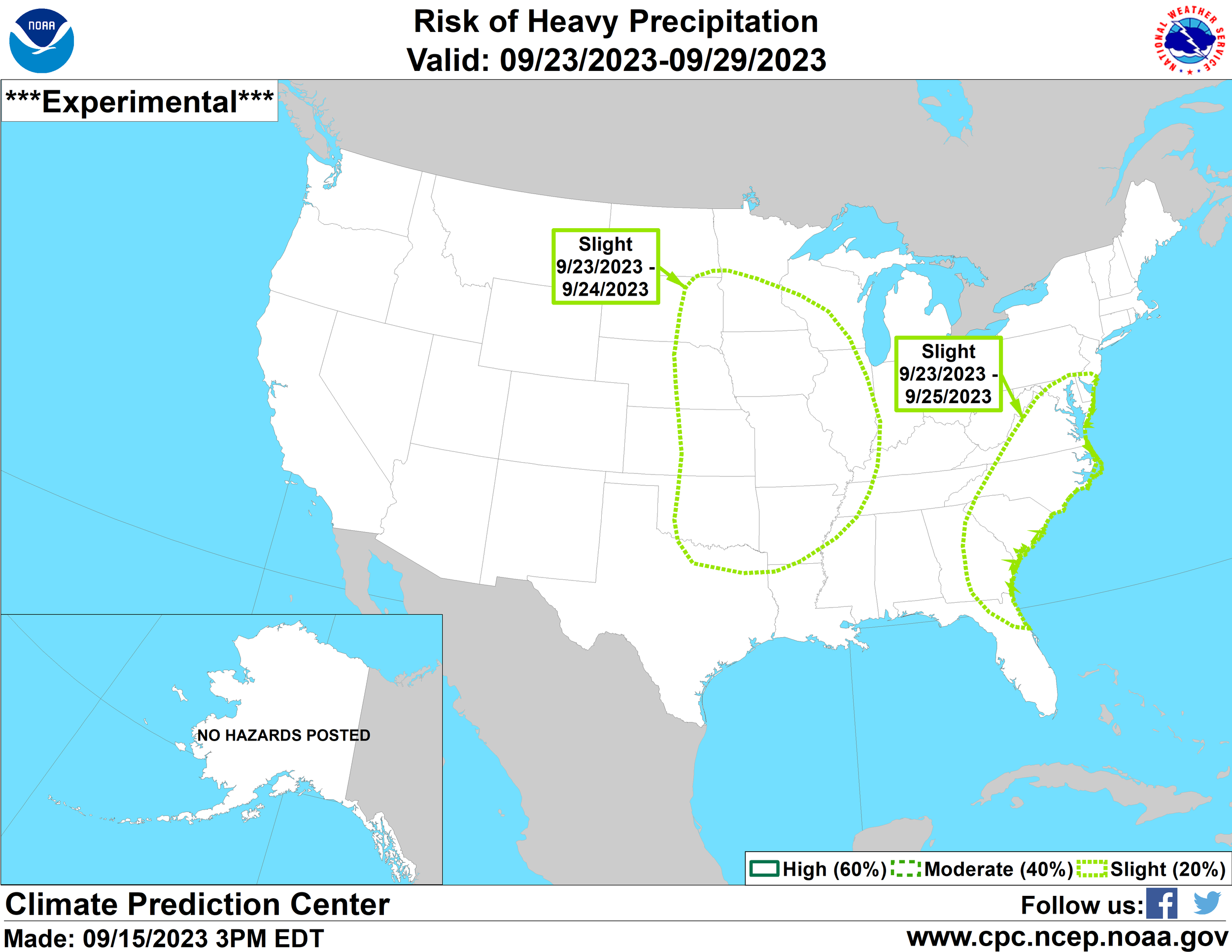
As drought continues to lead to lasting impacts on the Upper Midwest there continues to be some hope for some beneficial rainfall as we head towards the end of September across the Central US as a more amplified pattern brings stormy conditions and moisture northward.
Based on guidance, a well-above-normal supply of moisture will be present late this week into the upcoming weekend with precipitable water values approaching 1.5” to 1.75”. For this time of year that is quite high end. Assuming we can get storms to tap into this supply of moisture that would lead to good things.
Analogs show a healthy swatch of rainfall topping 1.0” across much of central and eastern Iowa, as well as northern Missouri. This is far from “drought-busting rainfall,” but it would certainly help add some moisture to the soils before we head into winter which is critical for next spring.
I do think this might be displaced too far east - I wouldn’t be surprised to see the heaviest rain along/west of I-35 with lighter amounts in eastern Iowa.
Above-normal precipitation continues to be the signal on the American GEFS model which is good news and has been the trend for the last week or so. The signal hasn’t wavered yet. The Climate Prediction Center is also highlighting the central US for the potential of heavy rainfall.
As far as temperatures go, near-to-above normal remains the theme through September and into early October. I have received a few questions about an “Arctic Blast” coming in early October and let me be clear - that will not happen. We will not see temperatures in the single digits. There is nothing aside from a frequently inaccurate model that showed a “cool down,” and even that was far from an “Arctic Blast.”
So no worries, we aren’t going to winter yet. In fact most guidance supports a very warm start to October.
A 15-day temperature outlook on the European ensemble shows temperatures hitting into the low 80s once again by midweek and 70s rolling towards Oct. 1.
-Meteorologist Nick Stewart


