Big Canadian High Pressure centers bring famously cold temperatures to Iowa in the wintertime while powerful Low Pressure centers bring strong blizzards. Either way, winter tends to see some of the most extreme pressure changes out of any other time of the year.
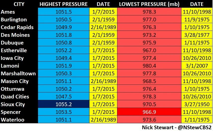
Iowa’s ASOS station pressure data.
The highest recorded pressure at an Automated Surface Observing System (ASOS) station in Iowa was a whopping 1055.2mb in Sioux City in January of 2015. January 7, 2015 holds the top spot in nine of 15 reporting stations in the state of Iowa. Meanwhile for the eastern half of the state February 1, 1959 sits at top.
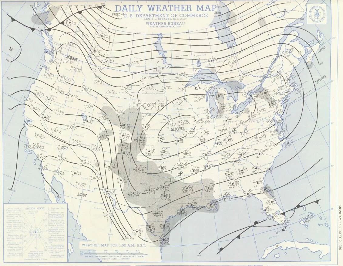
Surface map valid midnight CST on Feb. 2, 1959 (National Weather Service)
On Feb. 2, 1959 at midnight, a strong area of High Pressure was analyzed building across the state of Iowa. The 1048-1050mb High was starting to weaken as it shifted east.

Surface map valid noon CST on Feb. 2, 1959 (National Weather Service)
By noon Feb. 2, the ridge axis had passed Iowa and was analyzed down to about 1040mb, passing right over eastern Iowa.
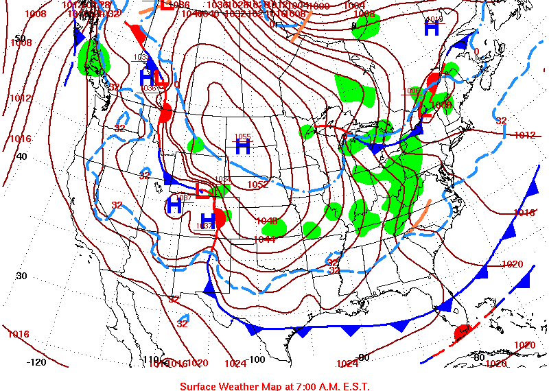
Surface map valid 6 a.m. CST on Jan. 7, 2015 (National Weather Service)
The highest-recorded pressure for much of the western half of Iowa occurred on Jan. 7 2015 as a powerful 1055mb High pushed in from the Dakotas. It managed to hold onto 1055mb strength, entering the Missouri River valley into northwestern Iowa hitting Sioux City.

Only the months of January and February have a maximum recorded pressure
The strongest High Pressure centers are typical in winter, and thus it’s not surprising all of the High Pressure maxes occur in the months of January and February.
Low Pressure centers can vary more through the year.
The lowest pressure recorded in Iowa’s ASOS network was 966.9mb set on November 10, 1998.

Courtesy the NWS Marquette, Michigan
This borderline bomb cyclone dropped 23mb in 24 hours, from 990mb to 967mb, as it moved across the state of Iowa. According to the National Weather Service in the Twin Cities, this storm brought 60mph+ wind gusts in Minnesota including a 64mph gust at St. Cloud State University and a 62mph gust in Mankato just north of the Iowa border.
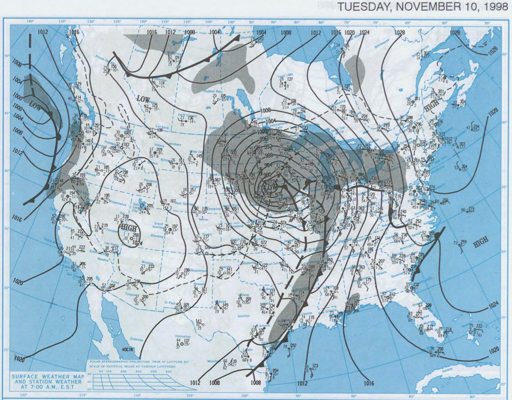
A powerful Low Pressure moved into Iowa on Nov. 10, 1998 hitting sub-970mb levels
The center of the Low Pressure moved through western Iowa bottoming out below 970mb. The pressure gradient on the back side of the low is very tight and was responsible for damaging wind gusts.

Unlike High Pressure centers, deep lows can happen throughout the year.
The lowest-recorded pressure at Iowa ASOS stations have happened more scattered throughout the year. Powerful autumn, winter and spring storms can bring a wide array of impacts to the Midwest. November is the favored month by just one more than January.