Tri-State tornadoes of 2017: Unique setups and challenges of forecasting in a radar hole
Nick Stewart – KGAN CBS 2 Meteorologist
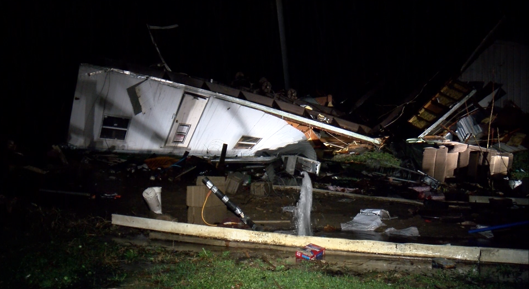
A mobile home lies in ruins after an EF-1 tornado strikes Versailles, IL on February, 28, 2017. Photo by Nick Stewart.
ABSTRACT
This past year, the Tri-State area (Iowa, Illinois and Missouri) saw several tornado events, as early as February and as late as December, which caused damage and injuries in several counties. Two of those tornadoes had no warning with them. Nowcasting was challenged by sub-optimal radar coverage, as well as the unique setups including an early-season QLCS tornado outbreak, overnight bowing segments with embedded supercell structures, and supercells forming on a differential-heating boundary. Despite these challenges there were no serious injuries or fatalities thanks to good forecasts leading up to the events, and the life-saving decisions those in the path of the tornadoes made.
EVENTS
During 2017, six significant severe weather days stand out with five of them being tornado producers. Definition of significant severe for the purpose of this report signifies events that produced a tornado, events that created widespread wind damage resulting in injuries and significant property damage, or severe storms that dropped hail over 2" in diameter.
- 2/28/2017 - Nighttime Bowing Segments with Embedded Supercell Structures
- 3/6/2017 - QLCS Tornado Outbreak
- 3/25/2017 - Cold Core Tornadoes
- 6/17/2017 - Northwest Flow Baseball-sized Hail
- 10/14/2017 - Differential Heating Boundary Tornadoes
- 12/4/2017 - •Cold Front
Of the mentioned six events, we will be focusing on four events in particular that provide interesting forecasting challenges or unique scenarios. Those four events will be 2/28, 3/6, 10/14 and 12/4.
BACKGROUND - THE TRI-STATE RADAR HOLE
Fig. 1: The Tri-State area is served by five different National Weather Service WSR-88D radars. Most of the area falls in the less than fair coverage, with select areas in fair coverage as deemed by NOAA. Of the six tornadoes that occurred in 2017, two had no warning with them. Those two tornadoes were in the radar hole.
For weather enthusiasts, meteorologist, storm chasers and emergency managers familiar with the Tri-State area, the radar hole is not a new concept. It's widely discussed as a problem during severe weather operations. Storms have quite literally went under the radar undetected and produced damage.
In 2017, two tornadoes hit without warning in areas outside the "fair" coverage as deemed by the National Weather Service and NOAA (Fig. 1). One tornado had roughly a minute of warning before striking a home.
Fair coverage is designated as areas outside of a ~100nm ring surrounding each radar. Most dual-pol radar products are not effective outside of 70nm from a radar site.
CASE STUDY 1: February 28, 2017
As with most early-season severe weather events, forecasts take time to hone in on a singular solution. Early and late season events are generally driven by strong dynamics (wind shear) more than thermodynamics (instability). However, some instability is needed, which can be difficult to attain in February. Those details are generally worked out in the Day 1 (day of) time frame.
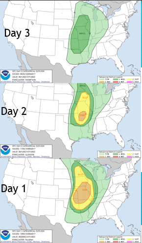
Fig 2: The Storm Prediction Center had a steady increase in severity in the days leading up to the event. Three days out, a Marginal Risk covered most of the area. The day before, the area was upgraded to a Slight Risk. The day of the event, an Enhanced Risk covered most of the area, with a Moderate Risk clipping the extreme southeast corner of the Tri-State area.
In the days leading up to the Feb. 28 event, confidence continued to increase that a severe weather event was going to take place across the Middle Mississippi River Valley (Fig. 2). A strong trough was forecast to dig into the area over an area of unusually high moisture and well above normal temperatures. Wind shear was forecast to be very strong, so a tornado threat was always a possibility.
Questions arose in regard to storm mode and just how much instability would be available for this event. Isolated storms are most likely to produce tornadoes. Forecast models showed a broken line of storms was likely by late evening.
Fig. 3: The 00z March 1 sounding from Lincoln, Illinois shows unidirectional wind fields above 850mb supportive of bowing segments. However, the lowest 1km has very high wind shear over 450ms/s2. The hodograph pictures also indicates very strong low-level shear and storm motions east-southeast which was important to get storms off of a cold front.
Storms were ongoing by 5 p.m. across the Tri-State area. At 00z March 1, the normally-schedule sounding was launched from the US National Weather Service in Lincoln, Illinois, located just 75 miles east-northeast of Versailles, Illinois. The sounding (Fig. 3) indicated very strong low level shear well in excess of 400m2/s2. Generally speaking, 150m2/s2 is enough to support tornadic storms.
Additionally, despite it being after sunset, instability levels were quite high with mixed layer CAPE over 800j/kg.
The sounding indicated unidirectional southwest flow above 850mb supportive of bowing segments capable of damaging wind. However, given extreme low-level shear, tornadoes were going to be possible with the strongest storms, especially with a storm motion vector as indicated on the hodograph. The vector was important for two reasons, 1) the storm motion would help storms break away and get ahead of the approaching cold front and 2) the storm motion vector was parallel to an outflow boundary present from earlier convection pictured in Fig. 4.
Fig 4: A hand drawn surface analysis places an outflow boundary positioned from Quincy, Illinois through Lincoln, Illinois. Unseasonably warm temperatures in the mid 60s and seasonably high dewpoints in the upper 50s to near 60 sat in the warm sector of this potent storm system.
Fig. 5: An isolated supercell formed near the Kansas City metro and continues moving east-northeast into west central Illinois. Once the storm started interacting with an outflow boundary which enhanced low-level shear, the storm became tornadic.
A supercell formed along the cold front near Kansas City and continued moving northeast into northeast Missouri and west central Illinois. As the supercell began to interact with an outflow boundary, low-level rotation increased substantially. Multiple reports of funnels (Fig. 6) came into the NWS right as radar also indicated strengthening rotation.
Fig 6: A funnel was observed by multiple storm chasers and spotters just west of Hannibal, Missouri. Photo by Nick Stewart.
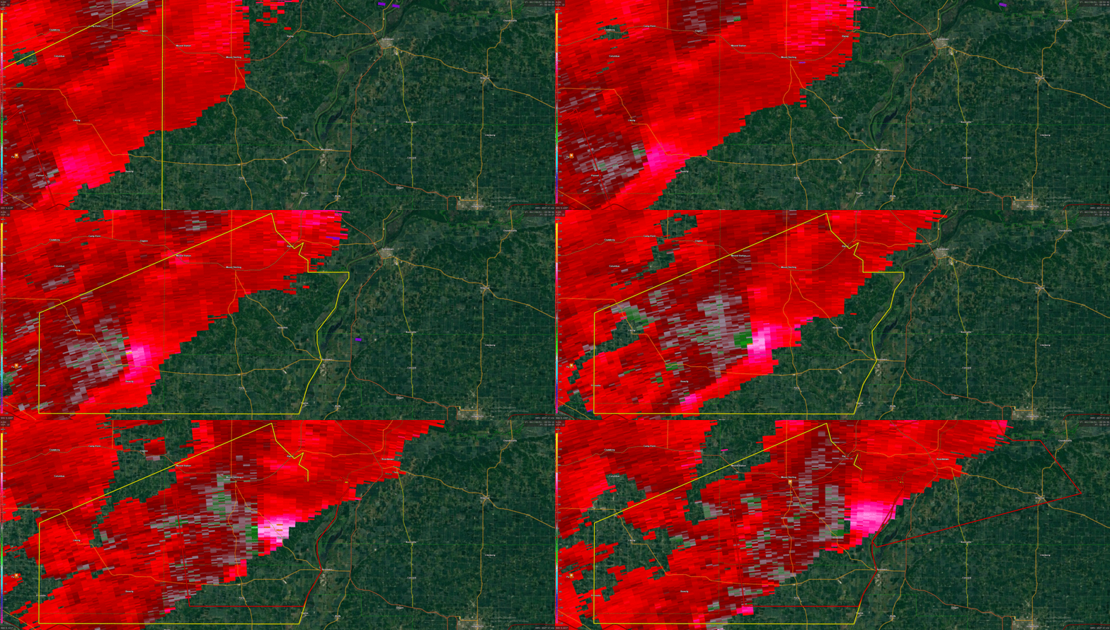
Fig 7: Storm-relative velocity animation from KLSX, the best radar to view this storm, indicated a strengthening mesocyclone on radar. A tornado warning is issued well before the rotation is on top of Versailles, Illinois.
Despite KILX being closer to the storm as it approached Versailles, Illinois, KLSX had a much better view of the storm. Storm-relative velocity scans show an increasing mesocyclone in the storm. Strong gate-to-gate shear over 100mph was observed on radar (Fig 8) just a few miles west of Versailles.
Additionally, the reflectivity representation showed a well-defined bowing segment (Fig. 8).
Fig 8: KLSX radar at 03:27z. Reflectivity (top left) shows a bowing segment as anticipated given the wind profiles in Fig. 3. Storm Relative Velocity (top right) and base velocity (bottom right) indicate strong rotation approaching Versailles with gate-to-gate shear in excess of 100mph. The shear was strong enough to have an NROT (bottom left) value of 1.09.
According to a damage survey by the NWS, an EF-1 tornado with estimated winds of 110mph struck Versailles. The tornado was on the ground for one minute, from 9:33-9:34 CST (03:33-03:34z), travelling .75 miles with a max width of 50 yards. There was one injury related to this tornado.
The worst of the damage occurred when two vacant mobile homes were thrown several yards and flipped. No one was inside the mobile homes at the time of the tornado.
In summary, Feb. 28 was an example of very high wind shear, especially in the low levels, compensating for rather unidirectional wind fields in the mid and upper levels. Storm motions played a pivotal role in removing this cell from the cold front, keeping it isolated, and allowing it to latch onto an outflow boundary which greatly intensified the low-level shear.
This case served as an analog for another event which occurred in December 2017.
CASE STUDY 2: March 6, 2017
On the heels of a late February sever weather episode, the beginning of March started much the same way. The Tri-States sat in between two larger ares of tornadic storms; one in eastern Iowa and another in southeast Missouri.
Fig. 9: The Storm Prediction Center increased the outlook from Day 3 through Day 1, ultimately covering all of the Tri-State area in an Enhanced Risk.
Starting three days out, the likelihood of severe weather was was looking possible across the Mississippi River Valley. Confidence continued to increase regarding the coverage of weather leading up to the event, therefore increasing the threat level from Marginal ultimately to Enhanced (Fig. 9).
Fig. 10: Directional and speed shear on March 6 was very intense ahead of a cold front in the evening. Surface winds (black arrow) were blowing in out of the south-southeast at 15kts. The low level jet at 850mb was blowing in out of the southeast at an impressive 70+kts. The jet stream at 300mb (yellow), winds were south-southwest at nearly 100kts.
Like February 28, 2017, wind shear was very intense ahead of an approaching cold front. However, unlike February 28, wind profiles had more directional shear (Fig. 10). This directional shear along a cold front is an indication of QLCS-based tornadoes, and that occurred especially in eastern Iowa.
Fig. 11: Instability was present ahead of a cold front on March 6 (left) with mixed layer CAPE values between 500-1000j/kg. Effective Storm Relative Helicity (center) was analyzed at an incredible 800-900m2/s2 indicating extreme low-level wind shear. Effective Bulk Shear (right) was also very high analyzed at 70-75kts over the Tri-State area.
On March 7 at 03z, the environment was analyzed at 500-1000j/kg (Fig. 11), sufficient instability to support severe thunderstorms. While low, the extremely high wind shear was more than enough to compensate for the lesser CAPE values. Particularly concerning was the effective storm relative helicity between 800-900m2/s2 (Fig. 11).
An important ingredient to the severe weather event on March 6 was the effective bulk shear. For one, shear was more than enough to support rotating severe thunderstorms in excess of 70kts (Fig. 11). Second, the shear vector was almost perpendicular to the cold front which was the source of lift for most thunderstorms.
For a tornado-producing thunderstorm, a storm would need to get ahead of the approaching cold front to prevent it from getting undercut. With a vector driving storms away from the cold front, storms should be able to become surface-based.
Fig 12: A line of severe thunderstorms was well underway by 03z March 7. There were also multiple tornado warnings along the line of thudnerstorm activity.
By 03z March 7, a long QLCS stretched from Minnesota south into the Southern Plains. Severe Thunderstorm Warnings stretched the entire state of Missouri with embedded tornado warnings as well. With multiple tornadoes were confirmed either during the event or during surveys in the days that followed. Overall this was a fairly impressive QLCS tornado outbreak.
In the Tri-States, a tornado-warned storm developed near Macon, Missouri and continued northeast all the way into the city of Quincy, Illinois. This particular storm was a little farther ahead of the main line and not right on the cold front (Fig. 12).
Fig. 13: KLSX radar reflectivity (left) and storm relative velocity (right) at 3:45z March 7.
A tornado-warned storm approached the city of Shelbina, Missouri at 04z. There was a tornado already reported with this storm near Macon, Missouri to the west which helped give advanced warning.
Radar indications weren't particularly interesting on storm-relative velocity, however the radar beam is at 10,000ft AGL. On reflectivity, there is an interesting hook feature placed over a weak velocity couplet (Fig. 13).
Fig. 14: Storm reports on March 6, 2017.
Overall, the March 6 event was very widespread with nearly 650 storm reports, including almost 80 tornado reports. Tornadoes stretched from Minnesota south into Arkansas and Oklahoma.
Fig. 15: Strong winds ripped the facade from a building in Emden, Missouri. (Photo by Nick Stewart)
Fig. 16: An EF-1 tornado partially ripped the roof off a home in Shelbina, Missouri. (NWS St. Louis photo)
Fig. 17: An aerial shot by the National Weather Service in St. Louis shows the damage to the Shelby County High School baseball field. A home in the distance also lost part of its roof. (NWS St. Louis photo).
A damage survey by the National Weather Service in St. Louis confirmed a, EF-1 tornado struck Shelbina, Missouri. The tornado partially ripped the roof off a home (Fig. 16) and did considerable damage to the Shelby County High School baseball field (Fig. 17). The NWS survey team estimated winds at 100 mph. The tornado tracked for 16 miles, for 16 minutes. There was one injury reported due to flying debris. The tornado was 150 yards in width.
CASE STUDY 3: October 14, 2017
While several rounds of severe weather occurred between the March 6 event and October, including a severe weather outbreak that brought baseball-sized hail, the next major tornado-producing event wasn't until October.
Fig. 18: The October 14 severe weather event had excellent forecasts going into it, with a Slight Risk at Day 3 and an upgraded Enhanced Risk the day of.
Forecasts were very good heading into the October event. A quasi-stationary warm front was the expected forecasting mechanism. Damaging wind gusts were believed to be the main concern prior to Day 3, however by Day 2, concerns for storms forming and tracking along the warm front raised tornado concerns. The day of the event, an Enhanced Risk was issued by the Storm Prediction Center (Fig. 18).
Fig. 19: Early morning cloud cover created a secondary boundary across northeast Missouri and into west-central Illinois by afternoon. With the warm front to the north, this differential-heating boundary (black) became the new concern for severe thunderstorm development.
In the morning and afternoon on October 14, cloud cover remained consistent with light rain showers also forming along the warm front. The cloud cover created a differential-heating boundary just south of the warm front. As seen in Fig. 19, Springfield, Illinois registered 86° with a 67° dewpoint south of these boundaries, whereas Bloomington, Illinois was sitting only at 70°, yet a dewpoint of 66°. Dewpoints remains unseasonably high south of the warm front. North of this front, dewpoints were in the low 60s with air temperatures also in the low 60s.
Fig. 20: Three-hour temperature change between 16z and 19z on October 14. South of the differential heating boundary where tornadic storms fired, the air temperature rose by eight degrees.
South of the differential heating boundary under mostly sunny skies, air temperatures were quickly rising in the early afternoon. Between 16-19z, temperatures rose by as much as eight degrees right in the area thunderstorms began to fire.
Fig 21: KDVN radar snapshot at 22:09z on October 14 with reflectivity (left) and storm relative velocity (right) at the time a tornado was ongoing near South Gorin.
Thunderstorms began to fire around 20z south of the differential heating boundary and became severe. One storm closest to the boundary went severe. That warning was later dropped as the storm headed into Scotland County, Missouri. With no obvious radar signature, a tornado touched down and did damage to a home, occupied vehicle and destroyed a machine shed.
The radar beam at the time the tornado was ongoing was 11,462ft AGL.
Fig 22: Photos show the destruction to a machine shed which housed a tractor.
The tornado, which was rated an EF-1 with estimated 95 mph peak winds traveled just a tenth of a mile at 10 yards in width, completely destroyed one machine shed (Fig. 22) and did damage to two others. One person was in a vehicle at the time of the tornado and the car was hit by flying debris. The driver did not sustain injuries.
Fig. 23: Just over an hour later, a more classic-looking supercell formed along the differential heating boundary in southern Hancock County, Illinois targeting the town of Bowen, Illinois.
Approximately 75 minutes after the first tornado touched down, a supercell formed along the differential heating boundary in southern Hancock County, Illinois. The storm had a very impressive velocity signature with an NROT of .9 (Fig. 23). The NWS issued a tornado warning for this storm less than a minute prior to hitting a home west of Bowen.
Fig. 24: A tornado grazed the side of a home causing a large branch to fall on the roof.
The EF-0 tornado avoided directly impacting structures, however the outer wind caused a tree to fall on a home which was occupied by a family of eight. Training by the family what to do in case a tornado hits saved all seven kids from any injuries. The tornado traveled .8 miles uprooting another tree in the city limits of Bowen.


