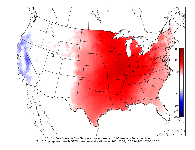
All signs continue to point to a likely significant warmup across the central US heading towards the end of January and beginning of February. Temperatures look to push 10-20°+ above normal for the Midwest, Mississippi River Valley and Great Lakes.
The above forecast looks at temperatures in the 12-14 day window, or Feb. 2-Feb, 4.
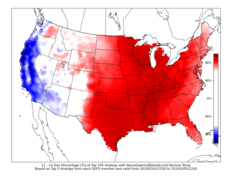
Using the same model, here’s a look at the probability of being above normal, which is well over 80-90% cross a significant portion of the US. This will likely lead to a big melt of the thick snowpack that has been built up through early 2024.
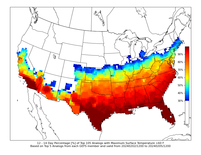
Continuing a look through the analogs, the chance of reaching 60° is pushing at least 30% towards the Iowa border which is rather impressive. This is a heavily smoothed forecast at this range, and I would not be surprised if we do see 60s push up to I-80. Keep in mind this is a two-week heads up and much can change.
I think upper 40s to low 50s is pretty much a lock for many in the central US.


Part of what will lead to the warming trend ties directly to the teleconnections. The NAO/AO indices are pushing well above 0, which is a strong warm signal for North America in winter. This continues through at least early February.
By early February the trend may drop closer to zero, or dip back towards negative values. This could potentially signal in the long range a cool down will return by mid-February, but let’s wait until we get a clearer picture on the warming trend prior to talking about another drop.

The latest long-range European Ensemble hints at a prolonged drop below zero which could send North America back into a cold winter. It is still winter after all. A little premature to go too in depth here, other than this is a watch item.

Again, likely getting a little ahead of ourselves here, but this mid-February chill is also reflected well in the overall pattern on the European Ensemble. Cold, northwest flow over the central and eastern US.

Now, back on topic to the late Jan/early Feb warmth: If this was summer, this would be a classic heat wave with highs in the 90s for the Midwest, for some context. A significant ridge in the jet stream develops in late January and pumps the unseasonable warmth well up into the Canadian Prairie.
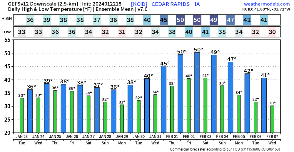
I’ll end with a look at one model’s take on the forecast for the next two weeks. Do not focus too much on the exact temperatures, but more so watch the trend. For this forecast in Cedar Rapids, Iowa, highs are looking increasingly likely to reach the 50s.
Until next time…
-Meteorologist Nick Stewart